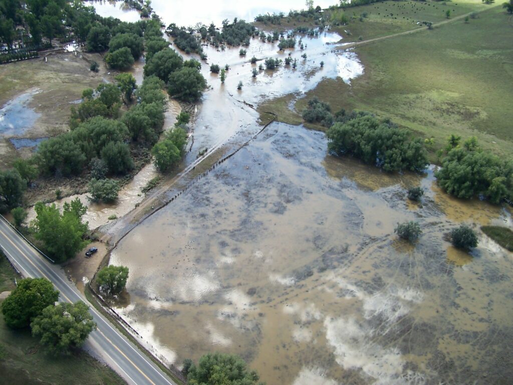
City Council on Tuesday rejected changes to the flood plan it chose in August, reaffirming support for a design that protects for larger storms but also goes against the stated positions of landowners of the property Boulder needs to protect 3,500 residents from a repeat of 2013’s historic flooding.
In August, a design concept was chosen: Variant 1, with an option that would protect against a 500-year storm, which has a 0.2% chance of occurring in any given year but is becoming increasingly likely due to climate change.
The decision drew criticism from the public and the city’s Water Resources Advisory Board, which recommended another design option, as did staff and consultants hired by the city. WRAB, in its annual feedback to council, lambasted elected officials for ignoring experts’ advice.
The University of Colorado, which owns the 308-acre parcel on which Boulder hopes to build, had also identified Variant 1 as the least desirable, as it requires detention of floodwater on 30 of the 129 acres on which CU intends to build housing and classrooms — acreage that was zoned for such purposes when the land use map was updated in 2017. In exchange for allowing the city to use the land for flood mitigation, the school will annex into Boulder and access its sewer and water systems.
Council in September requested more detention be incorporated into Variant 1. This increased inundation onto the Public-zoned land meant for development and made 30 acres of the park-zoned land unusable for athletic fields, another CU priority.
It also added to the project cost. The nearly doubled price tag turned council off, so that option was abandoned Tuesday.
Instead, the debate came down to two paths forward: Sticking with the original Variant 1 plan or shrinking the detention and therefore avoiding inundation of CU’s buildable acreage (and of land that the city hopes to preserve as open space). Less detention would also mean less protection: from somewhere between a 500-year flood and a 100-year event.
Two council members, Aaron Brockett and Bob Yates, had an appetite for a smaller detention area, seeing it as a necessary sacrifice to ensure the project can move forward.
“Public safety is important, but when we’re presented with tradeoffs, it’s a mix of what’s ideal and what’s achievable,” Brockett said. “I very much” want to protect against a 500-year event, but by going with the original plan, “we’re building in a significant delay.”
Other council members were unwilling to budge on the 500-year protection, instead preferring to let cost and university buy-in be the fluctuating factors. More important, they said, was getting a flood plan that offers the most protection possible for a reasonable cost.
“If we need that land (for flood work), we need that land,” councilwoman Mary Young said. “It’s part of the annexation negotiation.
We have something they need, they have something we need. That’s how negotiations work.”
The idea of a swapping the inundated land for acreage elsewhere on the property was discussed briefly. That would add to the cost, Mayor Suzanne Jones noted, which early estimates put around $36 million.
Lisa Morzel and Cindy Carlisle took the hardest line, asserting that CU’s hopes for its property were unrealistic. The university “should have realized” the limitations of the site when it bought the land in the mid-90s, Carlisle said.
“There are other parcels,” Morzel said. “We can work with CU, but I think 159 acres, of which 129 acres is developed, is completely unreasonable.”
Also uncertain is how willing another key partner is to work with Boulder: the Colorado Department of Transportation, which this week said no flood structures can be built in the U.S. 36 right-of-way, per Federal Highway Administration policies.
Senior Project Manager Molly Scarbrough maintains that conversations are ongoing and that the current breakdown is due simply to lower-level staff’s unfamiliarity with project details.
CDOT has shown its commitment to the project, she said, through its work with the city during the South Boulder Creek master plan process, completed in 2015. That was when the various flood options were narrowed down to one that included detention and a floodwall at the current location — all of the designs debated earlier this year were variations of that plan, and all make use of the state’s land.
“Every option we’re considering involves a floodwall along 36,” Brockett said. “We need to get something from CDOT as formal as possible, as quickly as possible.”
The consultant hired to do the engineering work during the design phase said CDOT generally won’t give approval on projects until all the details are known; Scarbrough concurred. City Attorney Tom Carr, in a tense exchange with council members, said it would be a tough sell to get a letter of intent from the state.
“I’m really concerned about asking staff to go to another government and ask them commit to anything when we haven’t committed to anything,” he said.
Mayor Jones bristled at the comment, noting the years of planning and the recent selection of Variant 1. The commitment has been made, she said — what’s happening now is the fine-tuning. Carlisle questioned how a master plan option and design concept could have been pursued and chosen without assurance of CDOT’s OK.
“Staff has not done its job,” she said.
“That’s not fair,” Carr rejoined. After some cross-talk, he said that staff “will certainly do as council directs us (but) the expectation that we can force a government to give us a promise is pretty high.”
— Shay Castle, boulderbeatnews@gmail.com,
Want more stories like this, delivered straight to your inbox? Click here to sign up for a weekly newsletter from Boulder Beat
CU South Aaron Brockett Bob Yates Boulder CDOT Cindy Carlisle city council city of Boulder Colorado Department of Transportation CU CU South dam detention Federal Highway Administration flood control flood mitigation flood protection flood wall Lisa Morzel Mary Young South Boulder Creek Tom Carr U.S. 36 University of Colorado Water Resources Advisory Board

